Antarctica
Viking expeditions runs a series of Antarctic expedition cruises during the Antarctic Summer (December to February) season. We traveled aboard Viking Polaris departing from Ushaia Argentina and returning there 14 days later. Here’s the account of our voyage.
Note: None of my images include AI generated content.


From Buenos Aires, Viking Expeditions flew us by charter to Ushuaia in Argentina's Tierra del Fuego province. Ushuaia is the southern-most city in the world. It's on the Beagle Channel, named for it's discovery during the transit of the HMS Beagle in 1831. That expedition is also famous for the presence of Charles Darwin. It resulted in his formulation of the theory of Evolution.
At Ushuaia we boarded our ship the Viking Polaris and settled in. Sail-away was at four in the afternoon.

We left the Strait a few hours later and began our voyage across the Drake Passage which is famous for being the roughest and most dangerous sea in the world.
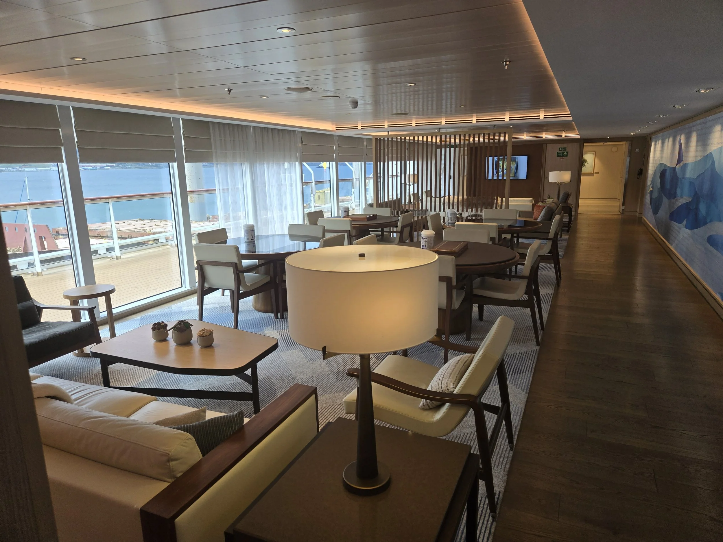
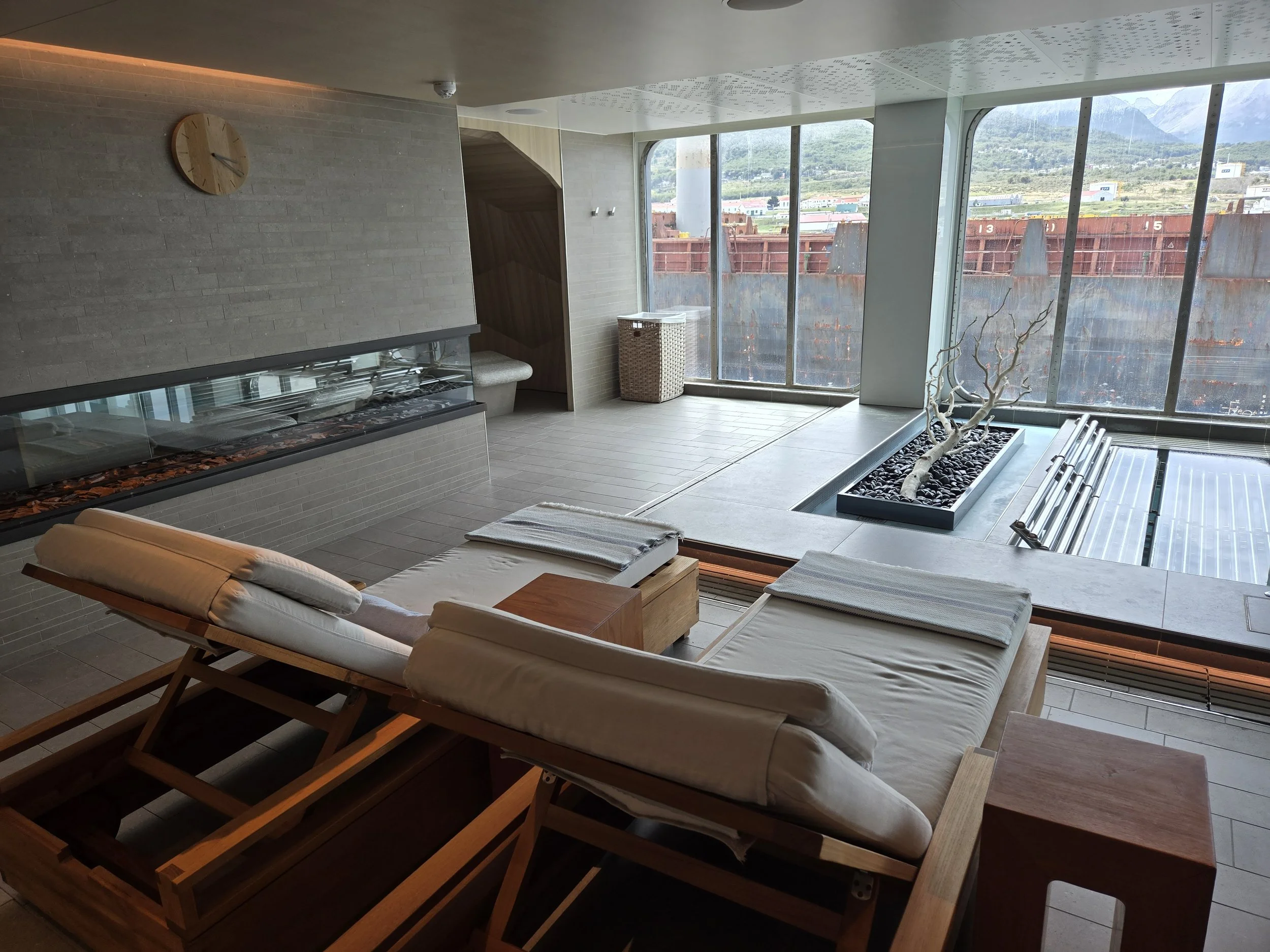
The next day was spent at sea. We were fortunate that the weather was extremely good (at least for that part of the world) and our ship was made for those seas. We were very comfortable in our luxury expedition ship. Here’s a gallery of cell phone shots from around the ship.


The next morning I saw our first iceberg and took this photograph from the ship.
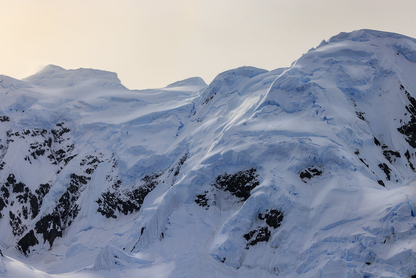
Yes, the ice really is that blue. You expect black and white to be the palette of Antarctica. Instead, the realm of Antarctica encompasses every possible shade of blue.

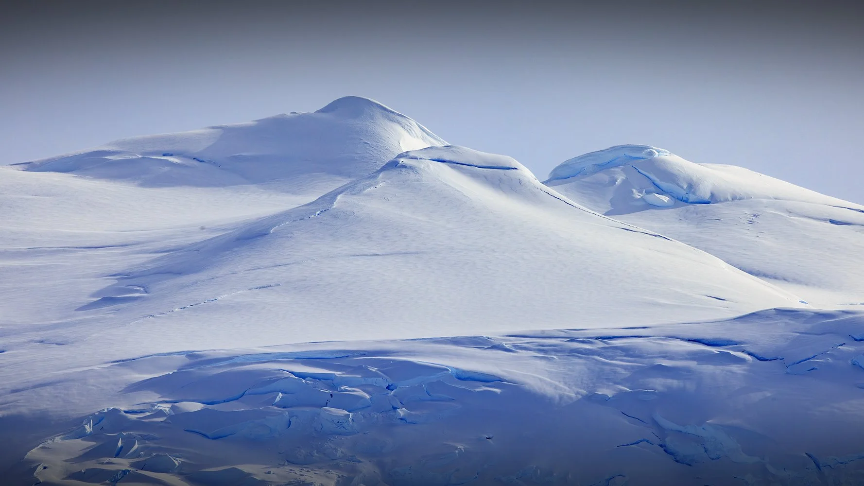
After our transit across the Drake Passage, we saw our first glimpse of the Antarctica peninsula as we sailed toward the Melchior Archipelago.
I will probably never have such an opportunity again. It was critically important to capture the colors and the light as accurately as possible in beautiful compositions. It took all my skill to faithfully capture what I saw.
It's difficult to describe my feelings as I took these photographs. I felt a great sense of adventure and also felt immensely privileged to be there. The beauty of the place was overwhelming. There was awe, excitement, anticipation and invigoration all at once.


After reaching the Antarctic Peninsula our ship sailed to the Melchior Archipelago. The Archipelago contains (I think) nineteen islands named Alpha, Beta, Delta, etc. The following photos are from our entry into Dallmann Bay at Gamma Island where we would stay the remainder of the day.
Dallmann Bay at Gamma Island is the site of an active Argentinian research station.
BTW: our ship did not use anchors to stay in position. Anchors damage the sea floor and harm sea life. Our ship used a dynamic positioning system. The system monitors the ship's position by GPS. If the ship begins to move the system uses the ships thrusters to counteract the movement. The ship stayed rock steady and never moved an inch without having to deploy anchors.


As we sailed into Dallmann Bay Melchior Base research station became visible around the cliffs and glacier ice.
If you look closely you can see that the snow at the base of the glacier is actually partially covering the roof of the station. This is during the warmest part of the Antarctic summer so I can only imagine what the show and ice does to the station in the winter.
Also, it seems like an avalanche or a ice calving could smash the station at any time. Not sure I'd want to live and work there.

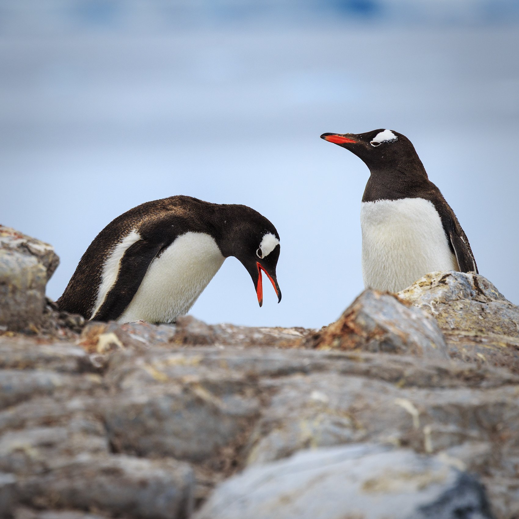
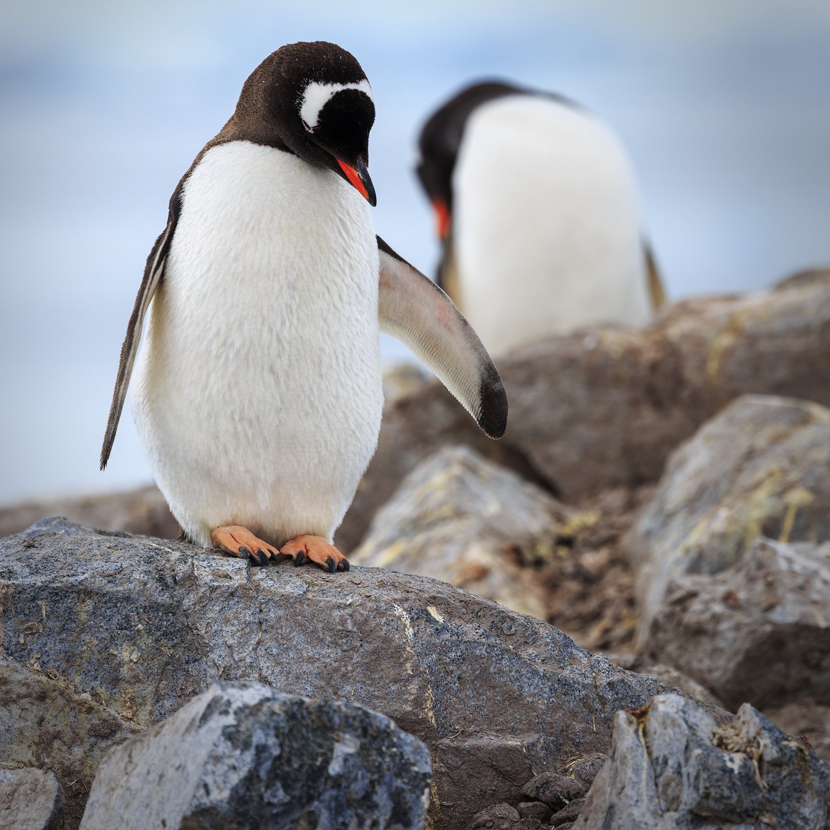
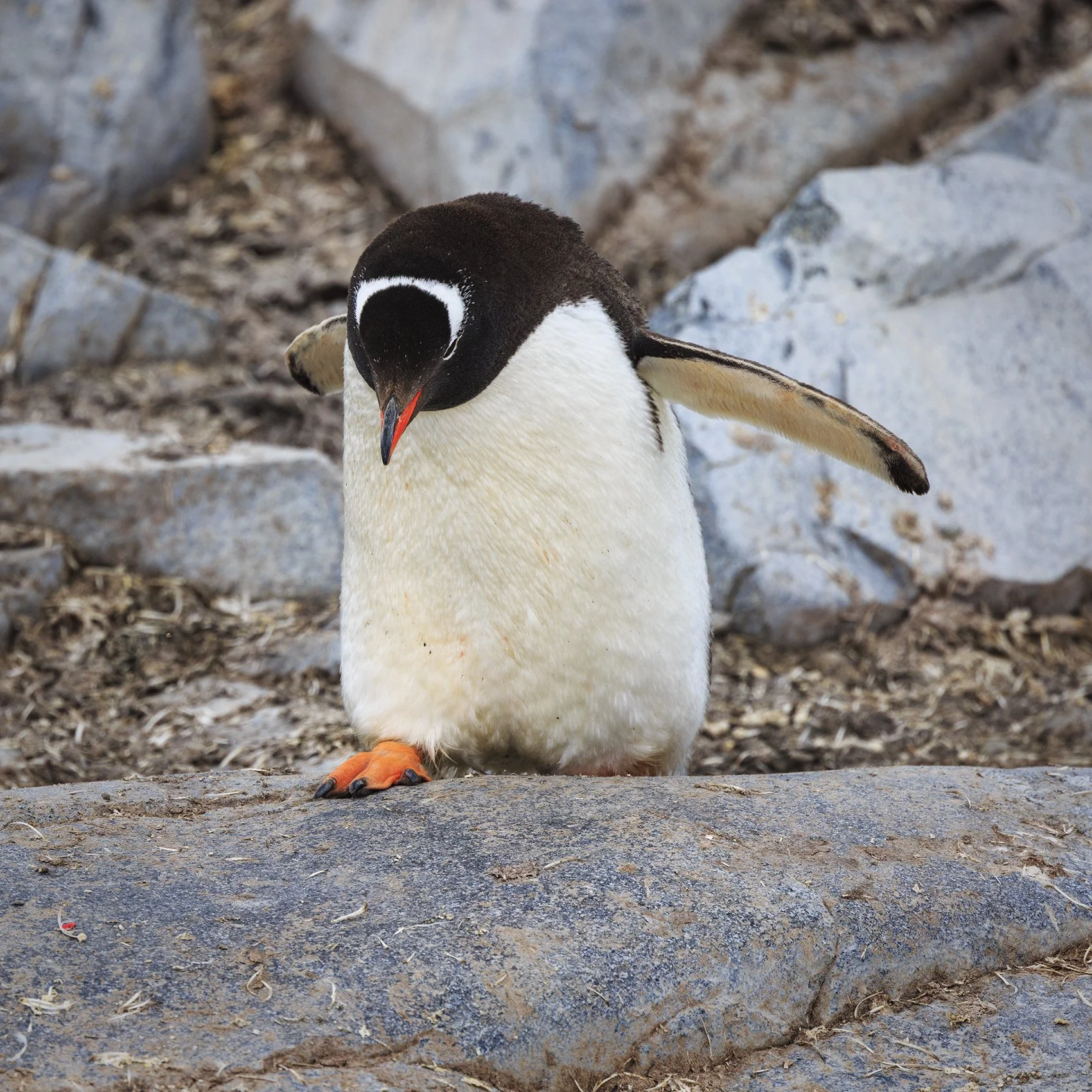
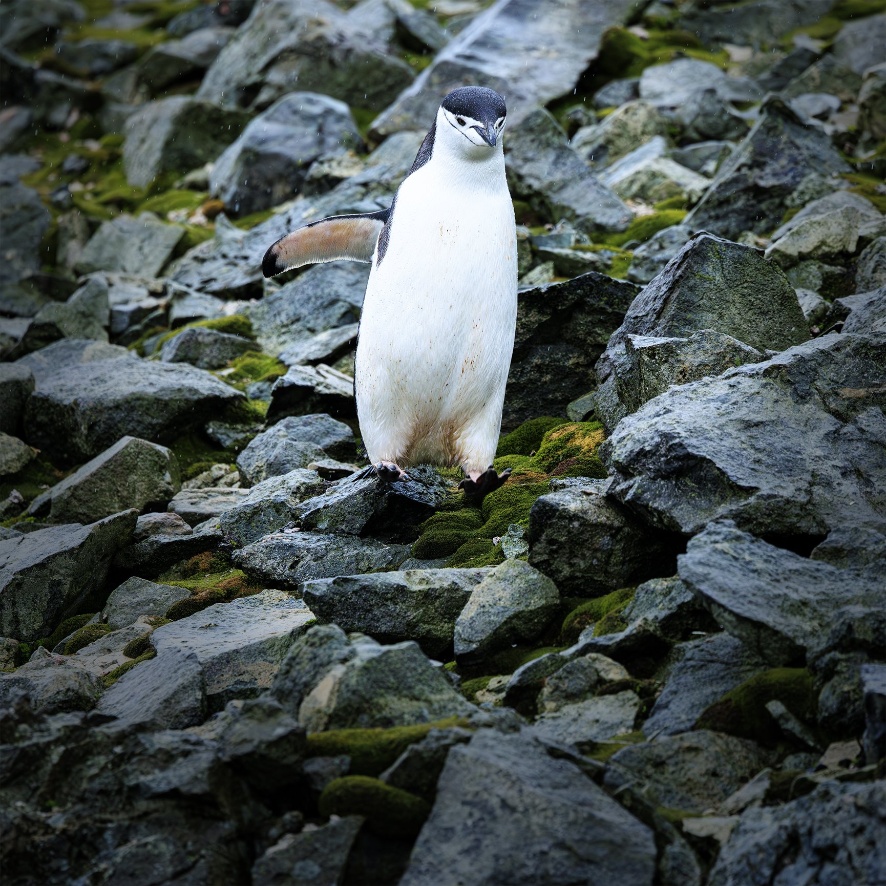
This little guy welcomed us to Dallmann Bay. He's a Gentoo penguin.
They look rediculously clumsy on land but they shoot through the water like bullets.

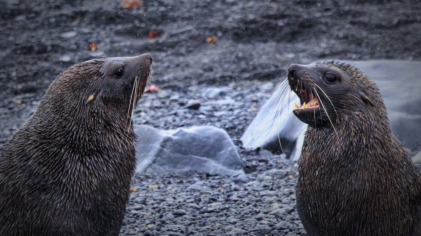
This Antarctic fur seal didn't seem to be very happy to see us. She decided to move back down the rocks and into the sea.
BTW: Antarctic fur seal's are technically sea lions. They have external ears which makes them a member of the Otariidae clade of Pinnipeds (which includes seals, sealions and walruses).

These Antarctic shag cormorants possessed their own little island. They are the only species of cormorant in Antarctica.


These Weddell seals were having a snooze but one of them was awake enough to stare at us.
As you can see, they have no external ears and are true seals (rather than sea lions).
I think their face is very cat-like but I couldn't get over the dead black eyes. There's something eerie about that.
We had our first (of many) opportunities to get off the ship here. We did some sea kayaking and had a Zodiac excursion.
A number of glaciers empty into Dallmann Bay. We constantly heard giant ice falls as the glacier calved icebergs into the bay.
In these pictures you can see a big chunks of Ice just about ready to crumble. Scale is difficult to convey in a photo like this since no person or boat could be anywhere near such a dangerous place. I'm guessing the edge of the glacier here rose up 700 feet or more above the sea. Our ship would have looked like an ant next to it.
We never got used to the colors of the glacial ice. It contains every shade of blue you can imagine. I swear the ice glows with some kind of inner energy.


Our ship sailed away from the Melchior archipelago over night. The next morning we woke up in Dorian Bay just off Port Lockroy. Actually, I woke up at about 2:30 am as we sailed into the bay. That far south the sun was setting at around 11 pm and coming up at 2 or 3 in the morning.
I took this photo later from a Zodiac boat as we headed to Damoy Point in Dorian Bay. It was our first chance to go ashore since we'd arrived in Antarctica.
What an incredible place to be. Like everywhere else it was beautiful in a way that literally took my breath away.

According to the time stamp and adjusting for time zones I believe this photo was taken at about 4:30 am. Notice how high the sun is in the photo.
As I remember I took it from the open balcony of our state room. The "balcony" on the expedition ship is really a large window that makes up the entire sea-ward side of our state room. The entire top half of the window can be opened. That made the seating area of our state room open to the outside as if it were a balcony.
It was pretty cool being able to open almost one entire side of our room to the outside. Actually you might say it was so cool it was ice cold. It was generally pretty cold outside (Antarctica, duh). We didn't tend to keep it open for long.
In any event, this photograph is of Damoy Point which forms one side of the protected harbor of Dorian Bay. Photographically the picture was pretty basic to take -- just set the shutter fast enough to hand-hold the camera and maximize the aperture.
We would go ashore in Dorian Bay later in the day.


Here's another photograph of the mountain taken later in the day after we went ashore. This was taken from the opposite side of Dorian Bay but the view of the sea between us and the mountain is hidden by the rise of the snow cap in the foreground.
Of course the people in the photograph are not us since I was taking the picture. They may as well have been from the perspective of their isolation. We felt pretty much alone as we moved along the same trail some time later.
People were very spread out because there is a treaty limit to the number of people allowed ashore at any time. We never felt crowded except when getting on or off the Zodiac boats. We frequently felt we had places almost to ourselves on shore excursions as we hiked along trails marked out by the expedition team.
By the way, you never go off the trail. That's a very dangerous thing to do. Hidden crevasses are common.
One of the expedition team members showed us a hidden crevasse he had found by thrusting a long pole into the snow. It just kept going down and down, deep into an unseen and seemingly bottomless void under the snow.


On the other side of Damoy Point in Antarctica is Port Lockroy. It's the site of a former British research station that is now being maintained by a charity as a historic landmark site. The people from the charity came aboard our ship to talk about the history of the site.
They told us Viking lets them eat on the ship, have a shower and do some laundry in return for their talk. Apparently living in huts and tents in Antarctica for the summer does not include running water or fresh food.
Later we went ashore. The site has become a penguin colony so we got to see the old buildings and the surrounding penguin colony as well.

This is what it looked like when we were landing at Dorian Bay. We got to explore this old shelter, go for a hike over the ridge to see Port Lockroy on the other side and visit the nearby Penguin colony.

Penguin colonies really stink. They just smell bad. There is penguin crap everywhere. The whole place smells like rotting fish.
On the other hand, they are the most ridiculous and cute birds to watch. It (mostly) makes up for the smell.
Here's a gallery of Gentoo penguins just living their best lives...


We also had a Special Operations Boat excursion and another Zodiac outing at Dorian Bay.

After spending a long day at Damoy Point and Dorian Bay we returned to the Polaris for warmth, food and rest. As we slept that night, Polaris moved a few hundred miles around Anvers Island to Chiriguano Bay.
Early that morning I woke up and went to the bow of the ship to see where we were, I was stunned. The beauty of the place was overwhelming. The color of the sea was a deep saturated blue that I've never seen before. The light and shadow on the glaciers, mountains and icebergs was soft as cotton candy and constantly changing. The snow and glacial ice contained every shade of blue you can imagine.
I had the bow of the ship to all to myself (the benefit of being an early riser). There was no sound at all except the occasional crack-and-crash of glacial ice crumbling into the bay in huge blocks. The air was crisp and cold and so crystal clean it made it virtually impossible to judge distances.
Taking photographs required great care. It was a challenge to find a composition that made sense of the beauty around me. It was all too easy to be overwhelmed by the chaos of the ice and the mountains.
Going slow, taking my time, I pre-visualized images as I moved my view finder around the scene, zooming in and out with the lens as I went. At times I was able to find order within the chaos that I could fit in my frame (or in a wide panorama as I shot several of those that morning). Stories began to emerge. Stories of ice flowing and carving valleys, snow building up for thousands of years, icebergs being born from cataclysmic collapses and the sea receiving and underlying it all.
I hope some of these photographs convey even a part of my experience that morning.

Here's a photo of the mountains of Anvers Island. The composition should not have worked due to the asymmetry of the placement of the ice covered and bright sun-lit peak on the left and the dark stony peak on the right. They would have competed for the observers attention and unbalanced the composition.
Fortunately, a sharply pointed iceberg shaped like another peak was located right in the middle of the scene. The three points (the iceberg, the dark peak and the icy bright peak) set up a rhythm. It makes a hopscotch-like pattern for the eye to follow though the image. As a result I think it succeeds magnificently.

After shooting the previous image I decided to attempt a panoramic since the scene was just too large for a single 2x3 frame to do it justice.
I shot this panoramic hand-held over I think eight frames. It's not easy to make a successful pano hand-held over even three or four frames but I moved very carefully and kept my focus point very steady as it moved through the scene.
The reason I think this one works is that I put the glacier at the center of the image (more or less). This provides a sense of symmetry to the composition while also providing a flow (along the valley back to the mountain) for the eye to follow the the high points and then on to the peaks. Soft dappled sunlight provides just the right amount of contrast to capture a sense of depth and distance.

Another version…

Another great pano…

As I said, the light as I was shooting was gorgeous and constantly changing. I had to watch very carefully for patterns to emerge as the light changed. I had to be prepared to visualize and capture that decisive moment as it appeared for just a fleeting moment.

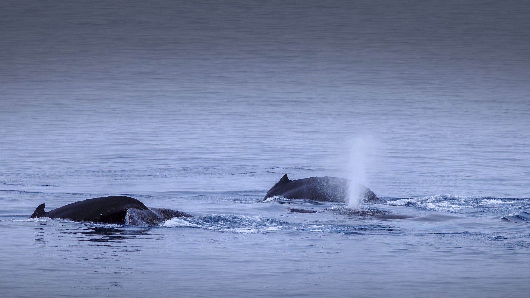
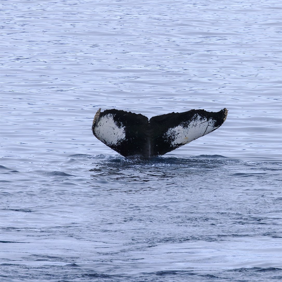
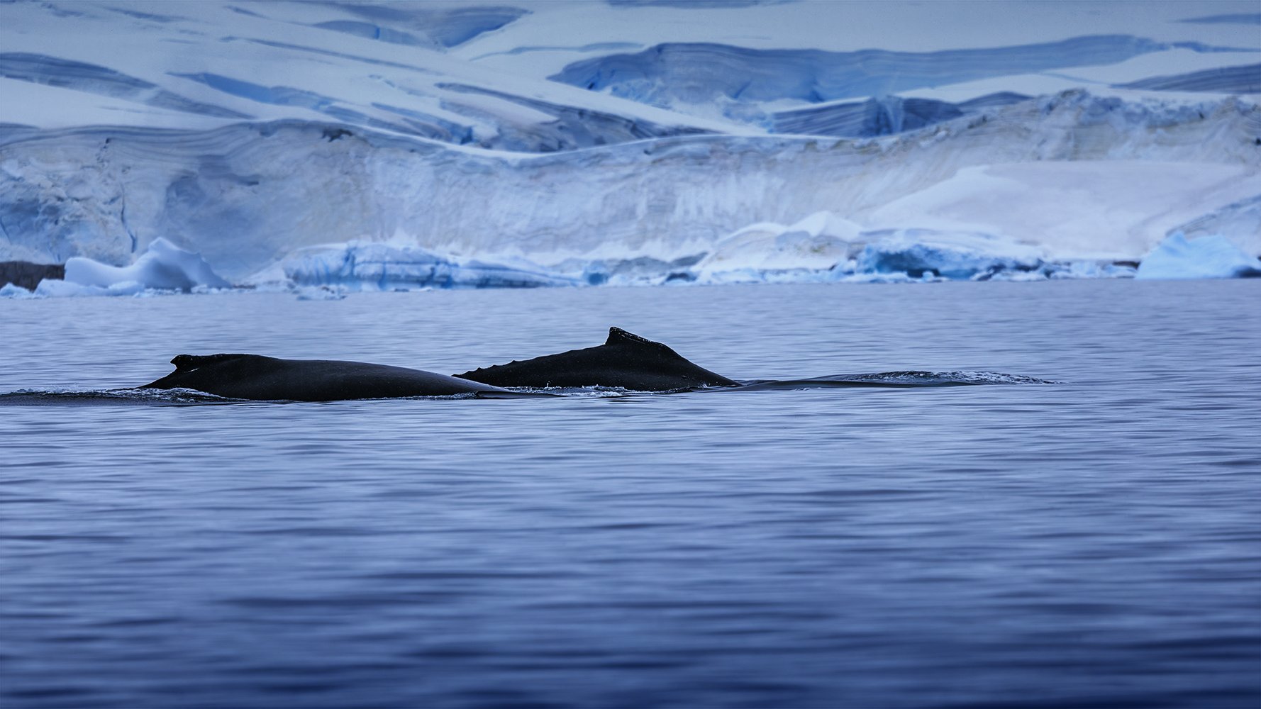
The other amazing thing about Chiriguano Bay was that we were surrounded all day by humpback whales. Single whales and small groups of two, three and four circled the bay all day feeding on krill shrimp. Sometimes they came close to the ship and sometimes we saw them from the Zodiac boats.
It's amazing watching these animals. They are enormous but glide through the water almost silently. The only time you hear anything as they pass by is when they surface and blow. The sound of the blow is pretty much what I expected just from imagining what a whale blow would sound like.
However, there was also the sound of the exhale as they expelled air from their lungs. It's like when a human exhales fully after a deep breath but so much deeper, richer and impactful. I swear I felt the pressure of their exhalation in my own lungs. At the very end there is often a vocalization from the whale that is totally otherworldly.
Unfortunately my images can't capture the sound of the whales exhaling. Even without sound, I think the images stand on their own.
Here's a gallery of whale photographs from the bay...


The next day we moved on to Orne Harbor and Fournier Bay. Again, the landscape photography was just amazing…


At Fournier Bay we had an opportunity to dive down 500 meters to the bottom in the Ship’s submarine. Viking has four subs named John, Paul, George and Ringo. We sailed in George. Here is Marla getting suited up for the ride over the to sub.

Marla transferring to the sub.

500 meters below the Antarctic sea.

View from the submarine.

Spoiler alert — we did return to the surface safely.
The following day, the Polaris moved on to Charlotte Bay on the mainland overnight. It was just a short hop of a few tens of miles accomplished as we slept the short 3 hour Antarctic night away.
The next morning I again woke up to achingly beautiful scenery all around the ship. Again I spent as much time as possible on deck with my camera, examining every inch of shoreline for incredible landscape compositions.
Here's some shots of icebergs recently calved from one of the many glaciers that enter Charlotte Bay and also the broken, cracked ice front from which it came. As always the most unexpected thing about the rugged scenes of glacial ice is the otherworldly shades of blue...


It wasn't just the glaciers meeting the sea that was beautiful in Charlotte Bay.
The water that morning was perfectly still. Above the glaciers the mountain range making up the spine of the Antarctic peninsula towerd and reflected in the still water.
The peaceful silence that surrounded me put me in a relaxed and methodical frame of mind as I examined the mountains and the sea for shots. With the water so still it was easy to incorporate reflections of the mountains in the sea that were so clear that it almost felt like you could turn the photograph up side down and not be able to tell it was inverted.


Later in the day we boarded a Zodiac boat and went ashore for an excursion at a place called Portal Point. There was a small sheltered bay there that was full of growlers (icebergs shorter than 1 meter), bergy bits (icebergs shorter than 4 meters) and berglets (shorter than 10 meters).
We saw whales sliding between the chunks of ice and Weddell seals basking on some. I'm glad we landed on the opposite side of the point so we didn't have to navigate that chaos to land.


Us at Portal Point. The expedition crew were always willing to take photos for folks.
After our excursion at Portal Point our ship moved on in the evening to our next landing point at Mikkelsen Harbor where we would find a large penguin colony.

En route to Mikkelsen Harbor.

A triptich of our wake as the ship sailed through the waves.

Search lights scanning for icebergs as we sailed through the darkness.

More iceberg spotting…

MIkkelsen Harbor was a whaling station until the early 1970s. Here’s a rotting wale boat on the beach.

Rotting whale bones on the beach. Once whaling stopped the station was taken over by a gentoo penguin colony. I think the current tenants make better use of the place than the whalers did.
The landing at Mikkelsen Harbor and the following day’s landing at Half Moon Island were about photographing penguins. There wasn’t much in the way of spectacular landscapes to photograph at these locations but the wild life photography opportunities were outstanding.
Here’s a slide show sampling of the hundreds of gentoo and chinstrap penguin photos I took…


Half Moon Island was our final shore excursion on our trip. We landed at the Northeast end of the island and were able to hike to the South end of the island.
At the South end of the island was the large chinstrap penguin colony that made up some of the previous gallery.
After visiting the penguin colony, which was on a small peak at the Southern tip of the Island we made our way down to the pebble beach. There we were to board our Zodiac boat to take us back to the Polaris.
We had some time to spend there. Not many passengers from the ship made the excursion that day. I guess many were tired since this was the end of our trip and we would be leaving for South America after the excursion.
That was fine with me. It increased the time we had ashore and decreased the number of other people to share boats with.
So after photographing the penguins at the colony we moved down the beach near another rotting whale boat.

As we made our way down to the beach a fur seal was taunting a penguin. It was the strangest thing to see. The penguin was trying to get to the water but when it chose a path among the rocks the fur seal would move and block it's path.
Then the penguin would go back up the shore, find another path through the rocks. Again the fur seal would move into the path to block the penguin.
This went on for quite some time. I was amazed at such advanced behavior on the part of the fur seal. It was just messing with the penguin for kicks (fur seals don't normally eat penguins and it made no attempt to catch the bird).
Anyway, after that another pair of fur seals suddenly appeared in the water off the beach. They were violently splashing in the sea and it became clear they were fighting. After a few minutes they left the water and took their battle up onto the beach.
I probably took a hundred photos of the fight between these seals. Here's a gallery of a few samples to close out this…


Following that final landing we had another uneventful sailing across the Drake Passage and around the horn to Ushaia to end our voyage.

The southern most tip of South America…

Entering the Beagle Channel.

Back in Ushaia for our flight home.